Ecological Imaginaries
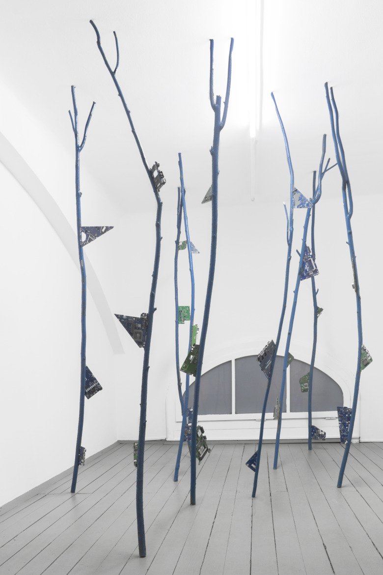
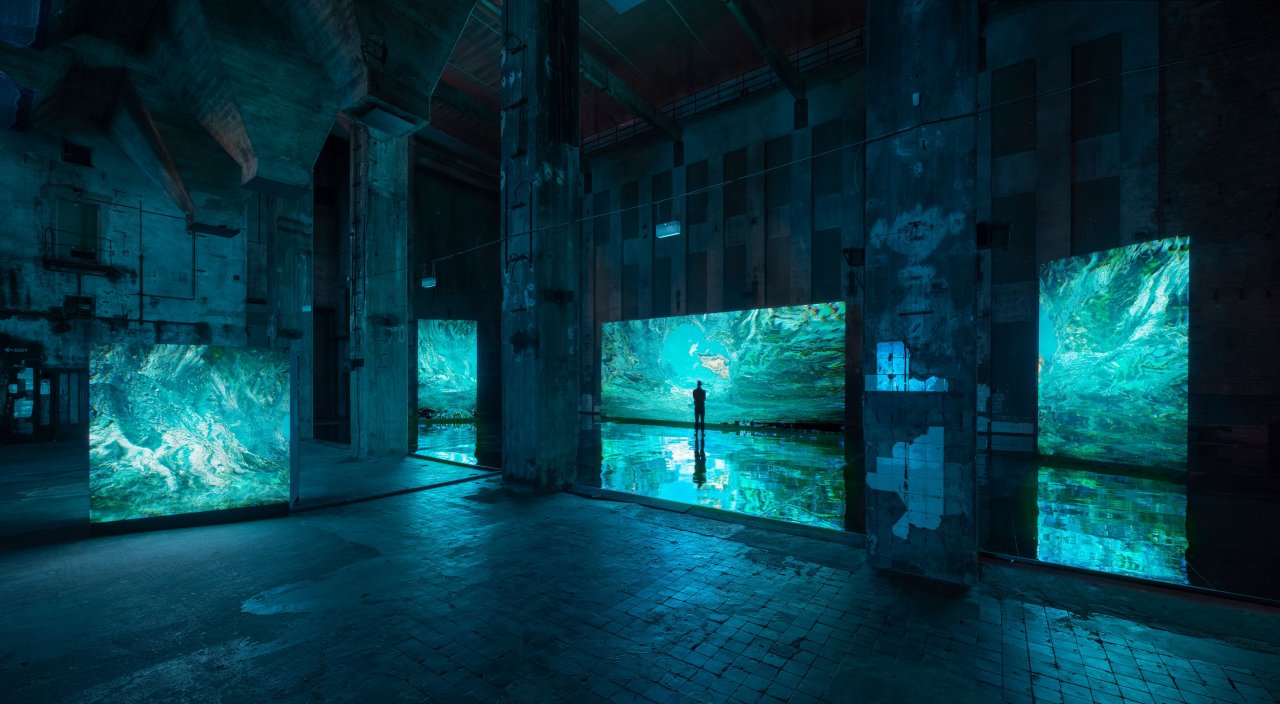
Carolyn Kirschner, Data Creatures, 2018
ANALYSIS
Design, as a discipline, is all-too-often expected to offer practicable, marketable solutions – especially in the context of climate change. I’m more interested in the role design can play outside of commercial contexts: as a research tool, or a tool to expand imaginations. In a world already flooded with ‘stuff,’ and in the face of problems as knotty as the global climate crisis, there must be room for more experimental, interdisciplinary, and open-ended design approaches, and for design outcomes which prioritize bringing about shifts in behaviors and value systems over generating profit.
In line with this, my contribution to Eco-Scenarios: Performing “Scale Critique” – the recent workshop at THE NEW INSTITUTE– explored the role of (and possibilities for) remote sensing technologies in shaping our relationship to planetary ecologies, drawing on excerpts from my ongoing research project NO_POLE.
What role does remote sensing imagery play in regions otherwise inaccessible to humans? How are these digital ‘scenes’ and ‘scenarios’ of ecologies constructed, and by whom? What new kinds of environmental narratives could they inspire?
Digital Arctic
Over the past decades, particularly from the 1970s onwards, more and more of the planet has been wired up, forming what journalist Neil Gross calls “the Earth’s electronic skin”. The Arctic Ocean for example – which is where my research is sited – has become an intricate landscape of sensing instruments and infrastructures. Polar-orbiting satellites track icebergs and observe wildlife; airguns trace undersea topographies; biochemical sensors float in the drift ice; radar stations collect atmospheric data; and hydrophones listen for underwater sounds. Even narwhals are recruited as remote sensors: fitted with radio transmitters to collect data from beneath the ice sheets, in areas otherwise impossible for researchers to access. Increasingly, we navigate the region through senses other than our own.
Tasked with siphoning data from their surroundings and transmitting digital fragments of the Arctic Ocean across the globe, the instruments are able to shape imaginaries of a region few will ever encounter in person. Maps, models, and surveys pieced together from pixels and data effectively become placeholders for the physical landscape and stage-sets for international decision-making: steering conservation strategies, climate policy, economic activity, and geopolitical affairs.
However, no matter how much data is collected – the polar ecologies are too complex to be captured by abstract digital models, and too vast to be stored on computer servers and silicone chips. The production of remote sensing imagery demands calculated decision-making: what data is worth recording, and what should be left out? How is data tidied, processed and interpolated?
As a result, remote sensing imagery of the far north is never neutral or objective, but rather shaped by the agendas of those producing the images – by extractive industries and nation states. Skewed by a focus on trade, resource extraction, territorial expansion, and a computable systems view of ecologies: these are the versions of the Arctic Ocean we see.
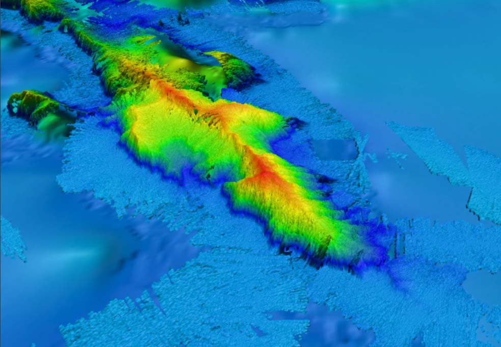
An ongoing territorial dispute over the region, for instance, triggered by the effects of global warming, relies on remote sensing instruments to resolve tensions between Canada, Denmark, Norway, Russia and the US, as the Arctic Nations are each vying to claim portions of the Arctic seabed. The scramble for the 1.1 million square mile area surrounding the North Pole, currently designated as international waters, coincides with the rapid depletion of sea ice, which promises unprecedented access to untapped oil and gas reserves below the seabed, and control over emerging shipping routes across the thawing ocean. Under guidelines set out by the United Nations Convention on the Law of the Sea (UNCLOS), nations are to substantiate their overlapping territorial claims with an assortment of geological evidence, to prove that the portions of seabed in question are a continuation of their continental shelf and, therefore, rightfully theirs (Figure 1).
This makes for an unusual international conflict, in which authority is not wielded through the brutal use of military force, but through the possession of information. Discrepancies between different nation’s models of one-and-the-same area in their submissions to UNCLOS, however, reveal attempts to manipulate the terrain in their favour and make their claim more viable— as Benjamin Bratton writes: “to hide, to scan, to camouflage, to self-display and to trick the world into seeing things not as they are but as they could be or should be”. The Arctic Ocean has started to multiply.
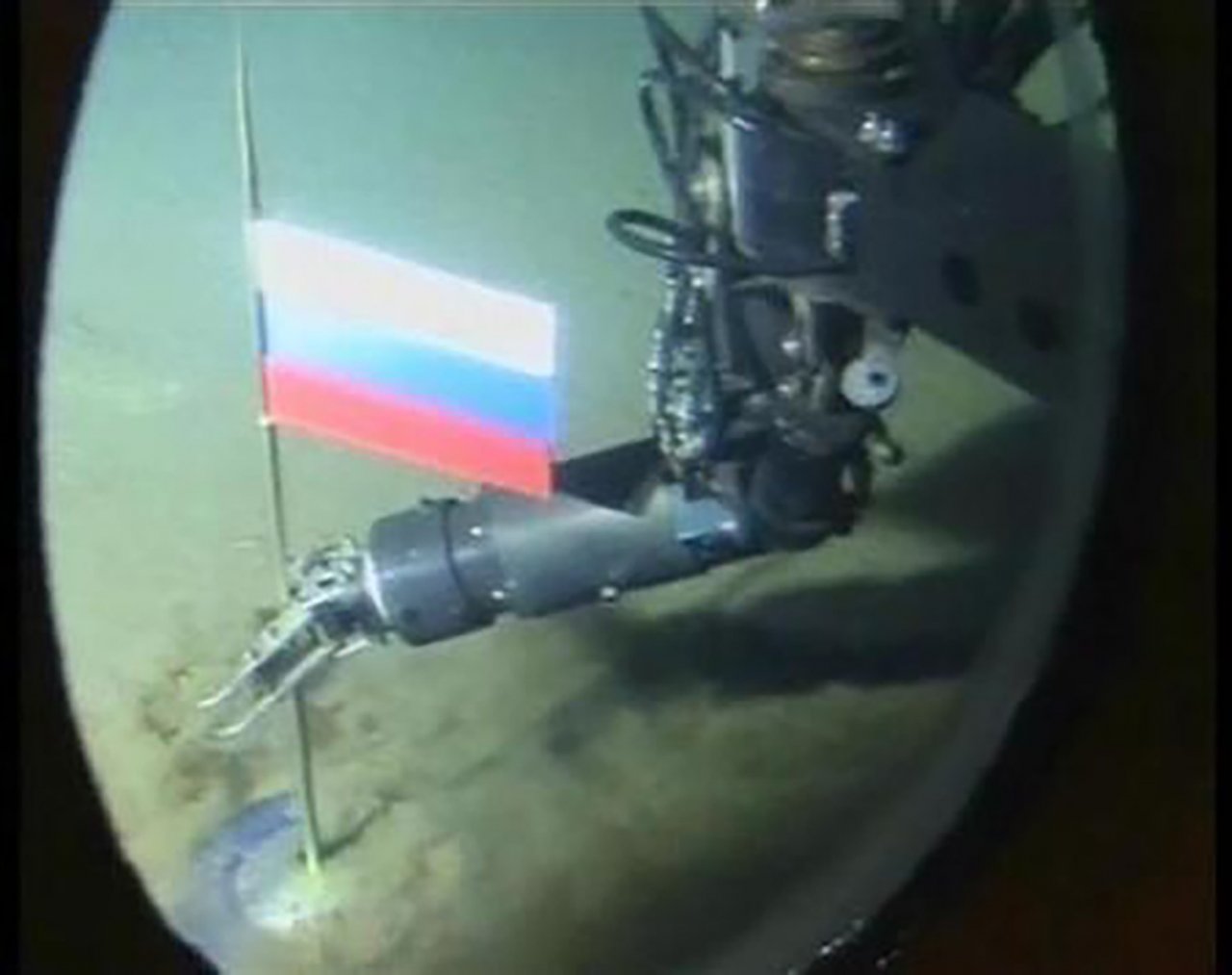
Meanwhile, in 2007, Russia deployed a miniature robotic submarine to plant a rust-proof titanium flag into the seabed at the North Pole, 14,000 feet beneath the surface, equipped with spotlights and cameras to record the symbolic claiming of pole (Figure 2). The contentious image widely circulated the planet, turning the pole into a stage-set for elaborate theatrics of nation-building, while relying on remote sensing technologies for ever more overt displays of power.
Role for Artists and Designers
With the narrow agendas of capitalist and colonial enterprises dominating the material record of the Arctic, evidently there is room for alternative ‘scenes’, models and materializations of the far north.
What would it mean for artists and designers to work with environmental data and machine senses? Beyond their role as scientific instruments – what are the possibilities for remote sensors as design tools, as image making and world building tools?
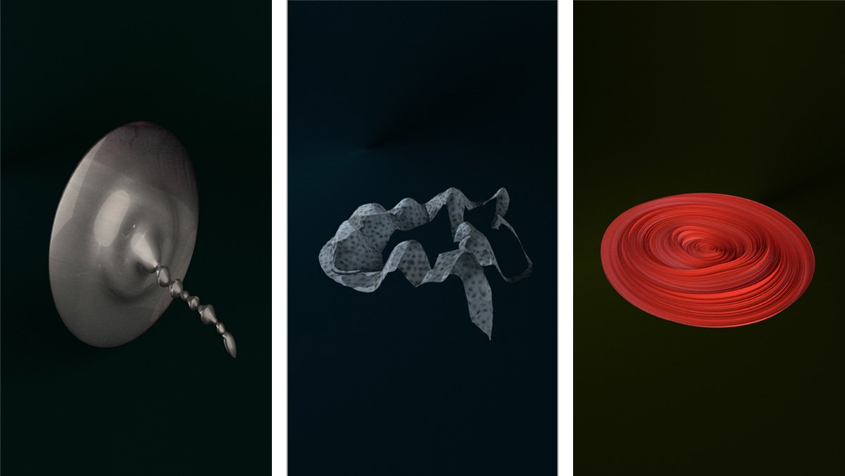
Data Creatures
To this end, I have been experimenting with alternative approaches to processing remote sensing data, in ways that foreground animal perspectives, indigenous perspectives, and machine perspectives of ecologies – which are excluded from prevailing materializations of the far north.
The following three creature-like digital models have each been generated from remote sensing data extracted from the Arctic Ocean – in fact, the very same data used to generate familiar maps and models of the region. However, I developed a series of alternative computational processes which are at odds with prevailing scientific approaches, to reveal alternative ecological imaginations.

Seismic blasting is a process the disputing Arctic Nations rely on to map the topography of the seabed. Research vessels tow airguns along the disputed coordinates, which blast loud, pressurized pulses of air into the ocean. These pulses spread and travel through the water column, until they rebound off the seafloor and their echoes reveal what lies below. The resulting maps, surveys and charts make up familiar paper trails of a border dispute at sea. This is the kind of documentation that is submitted to UNCLOS.
Unacknowledged by the bureaucracy of nation-building, however, are the destructive effects of seismic pulses on marine life – from zooplankton to whales and dolphins – as seismic blasts interfere in the organisms’ ability to feed, mate, communicate and avoid predators, ultimately causing a cascade of injuries and deaths.
This first creature processes data sets in a way that (for once) makes these rippling knock-on effects tangible: to reveal the violent intersections of geopolitical tensions with non-human worlds. The coordinates of the border in question forms the creature’s spine, around which I spun the waves of a seismic pulse and the skin of a dolphin, to generate this bulbous digital form. It offers an alternative representation of a border dispute at sea, drawing on the perspectives of non-human worlds.
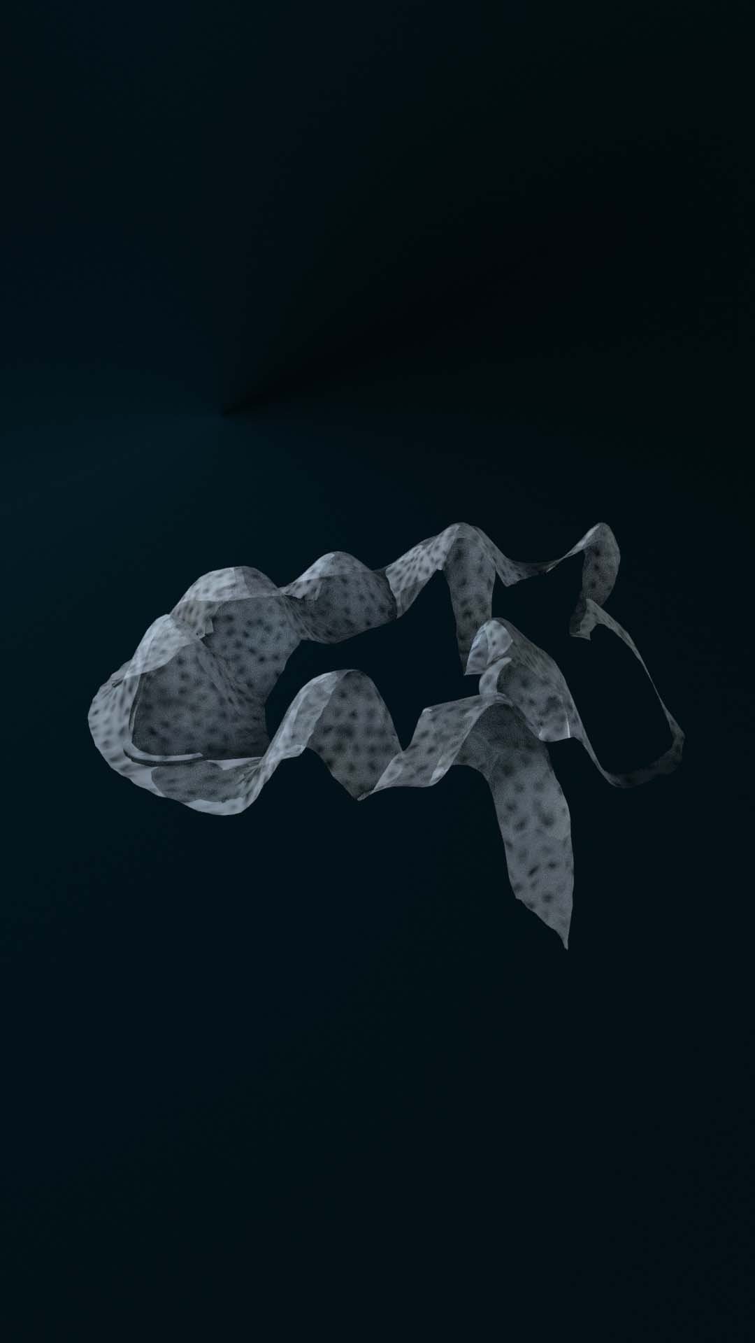
Where Western scientific procedures rely on establishing neat taxonomies and clear boundaries between what is human, animal, or landscape – indigenous models of reality, on the other hand, rely on their inseparability. The myth of Sedna, which is encoded into this sheet-like digital form, epitomizes these slippery ecological relationships. It tells of a sea goddess who rules over the Arctic Ocean from its depths – able to shapeshift from human form to ice to seal.
Her digital counterpart is an accumulation of satellite data: of seal migration routes and measurements of the Arctic’s fluctuating ice extent. The way the data is processed allows these otherwise disparate data sets to merge and congeal into a single being that is multiple states of matter at once, part ice and part seal, unclear where one data set begins and the other one ends in this three-dimensional form.
Data Creature 03
Magnetic Storm, 2003 (Conflicting Data)
Lastly, this third creature (Figure 5) is made from multiple, conflicting data sets of a magnetic storm. It is common for sensing instruments to return slightly divergent data sets of a singular occurrence. What usually happens is that raw data is then subject to a process of refinement: of calculating averages, deleting outliers, and interpolating information, in order to streamline findings into a single, more decisive version of events.

But in this case, the orange asymmetrical disc makes these underlying contradictions tangible. It is constructed from contradictory magnetic data of a singular event in 2003, collected near the Arctic circle. With that, the creature is able to contain multiple versions of the event, or even multiple realities at once – bringing the data into a dialogue that is at odds with the need for a singular version of reality predicated by Western science.
Encoded into each of these creatures is a set of alternative ideologies or side-lined worldviews: non-human, non-Western, and non-singular.
They represent a possible approach to scale-critique, as described in the prompt for this workshop. In their intentional embracing of scale-lessness, they become ambiguous, amorphous materializations of the landscape, which are functionally useless for the exploits of industry and nation states. But perhaps they can offer entry-points into expanded ecological imaginations, and hint at the multitude of worlds contained in remote sensing data, as we encounter the rapidly changing polar ecologies through senses other than our own.
NO_POLE is an ongoing design and research project, which has been generously supported by a grant from the Andrew W. Mellon Foundation, and a residency as part of the “At the Border” research program at A/D/O in Brooklyn. Previous iterations of this research have been published in Perspecta 54 , Evental Aesthetics , and The Polar Silk Road .
Carolyn Kirschner is a designer and researcher with a background in architecture. Her work explores the growing entanglements of humans, non-humans, emerging technologies, and planetary ecologies — using design as an investigative tool to materialise fragments from alternate or expanded worlds. Carolyn is a Lecturer in Design at Goldsmiths, University at London, and is currently artist-in-residence at ZKM Center for Art and Media Karlsruhe.
FOOTNOTES
- Neil Gross, “The Earth Will Don An Electronic Skin,” Bloomberg News, August 30, 1999
- V. G. Smirnov et al, “Satellite Monitoring of Icebergs in the Arctic Seas,” Russian Meteorology and Hydrology no. 44 (April 2019): 262–267
- Justyna Cilulko et al, “Infrared Thermal Imaging in Studies of Wild Animals,” European Journal of Wildlife Research no. 59 (December 2012): 17–23
- Robert C. Gisiner, "Sound and Marine Seismic Surveys", Acoustics Today 12, no. 4 (August 2016): 10–18
- Argo, "What Is Polar Argo?", February 2016
- Shannon Hall, "Frozen Researchers Will Greatly Improve Arctic Weather Prediction", Scientific American, November 11, 2019
- Ocean Conservation Research, "Deploying Hydrophones: Listening to the Arctic Ocean", accessed February 8, 2020
- Pat Brennan, "Narwhal Recruits Track Melting Arctic Ice", NASA: Global Climate Change, October 26, 2017
- Neil Shea, "Scenes from the New Cold War Unfolding at the Top of the World," National Geographic, May 8, 2019
- Durham University, "Arctic Maps", IBRU: Centre for Borders Research, 2020
- United Nations, "United Nations Convention on the Law of the Sea", November 10, 1982
- Irene Stracuzzi, Invisible Borders, self-published, 2017.
- Stephanie Holmes, "Breaking the Ice: Emerging Legal Issues in Arctic Sovereignty", Chicago Journal of International Law 9, no. 1 (June 2008): 323–51
- Benjamin H. Bratton, “Further Trace Effects of the Post-Anthropocene,” Architectural Design (AD) 89, no. 1 (February 2019): 14–21.
- Guy Faulconbridge, “Russian sub plants flag under North Pole,” Reuters, August 2, 2007
- Oceana, “Seismic Airgun Blasting: Overview,” accessed June 8, 2020
- Julie Cruikshank, Do Glaciers Listen?: Local Knowledge, Colonial Encounters, and Social Imagination (Vancouver: UBC Press, 2006), 128, 220.
- Frédéric Laugrand and J. G. Oosten, The Sea Woman, 2nd ed. (Alaska: University of Alaska Press, 2009).
- Space Weather Prediction Center, “Geomagnetic Storms,” accessed October 8, 2020.
- Carolyn Kirschner, “NO_POLE: Datascapes and Digital Ecologies,” Perspecta 54, 255-265 (2021)
- Carolyn Kirschner, “Remote Sensing the Arctic: An Exploration of Non-Human Perspectives of the Territory,” Evental Aesthetics 10, no. 1 (2021)
- Carolyn Kirschner, “Sensor Landscapes,” in The Polar Silk Road by Gregor Sailer (Heidelberg: Kehrer Verlag, 2021)
BEYOND THE LIMIT
-
editorial
Time for Climate ActionImagining possible futures – 50 years after “The Limits to Growth”
-
interview
The Addiction to GrowthDennis Meadows on The Need for a Mature World
-
essay
On Brown GoodsKarimah Ashadu Describes the Limbo Within Capitalism
-
interview
Capitalism is the Main ProblemKim Stanley Robinson on Climate Change and Science Fiction
-
interview
Respect What You HaveKinga Kiełczyńska on Reincarnation and The Limits of Art Production
Beyond The Limit | Art |
-
interview
The Art of ChangeEmma Enderby on Arts and Speculative Scenarios
Beyond The Limit | Art |
-
interview
We Just Want The HoneyAna Prvački on the Lessons of Nature for Societal Change
Beyond The Limit | Art |